Field Boundary Management
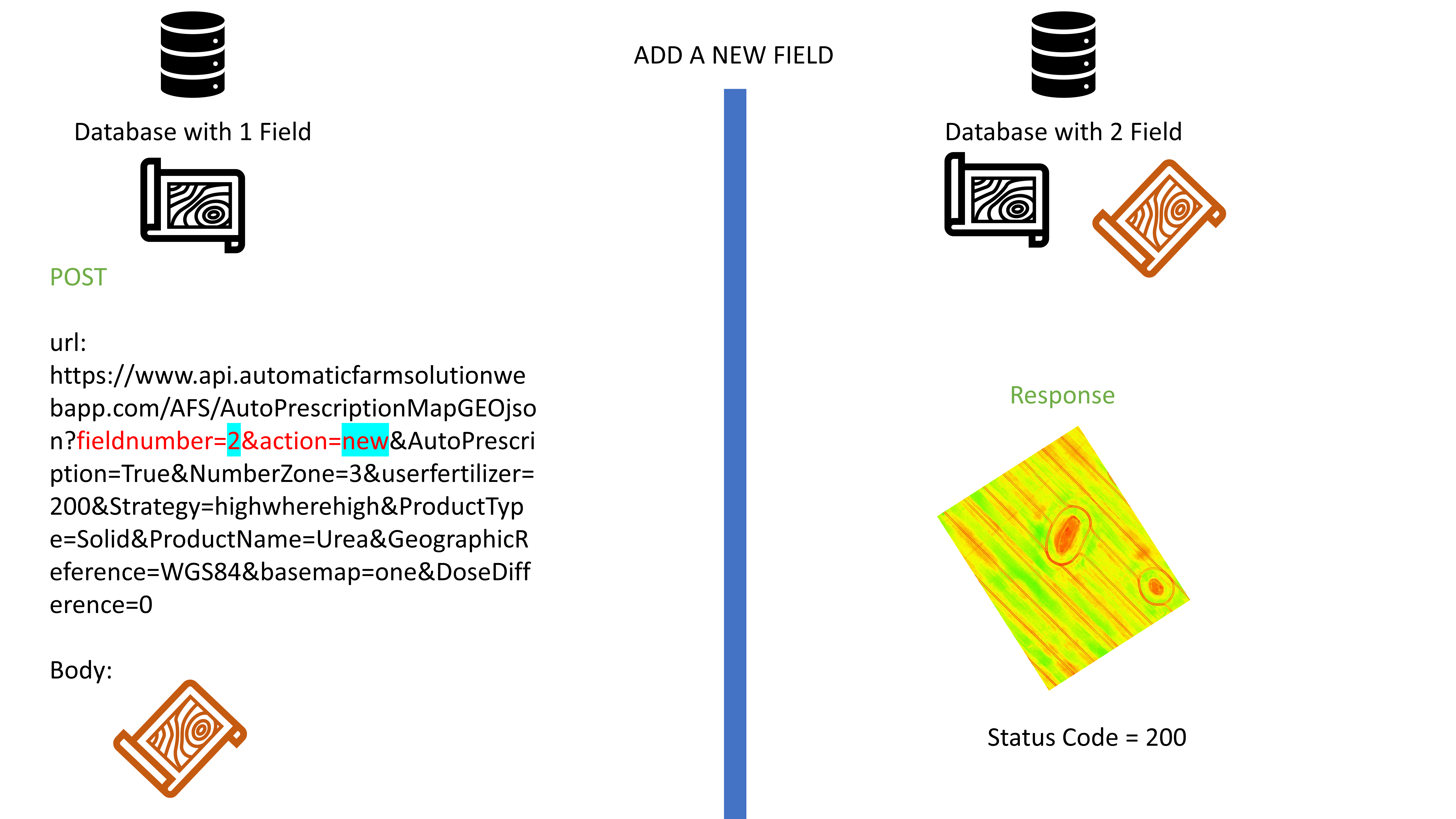
The operations allowed in our API to be able to add/edit fields is determined by the action API parameter, which can be set as:
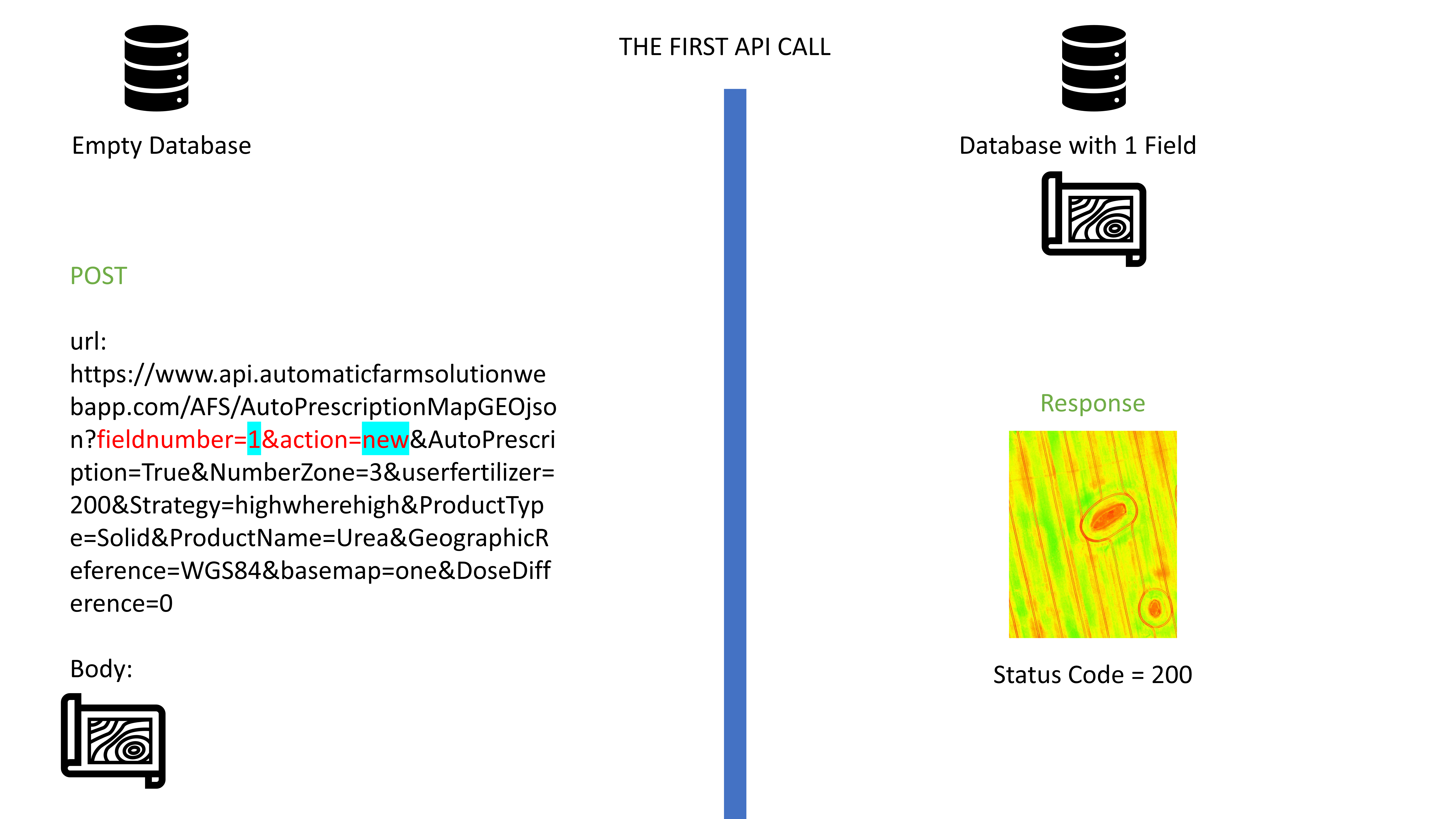
- new, which means that the geojson loaded as body section of the request it will accepted and saved in our database.
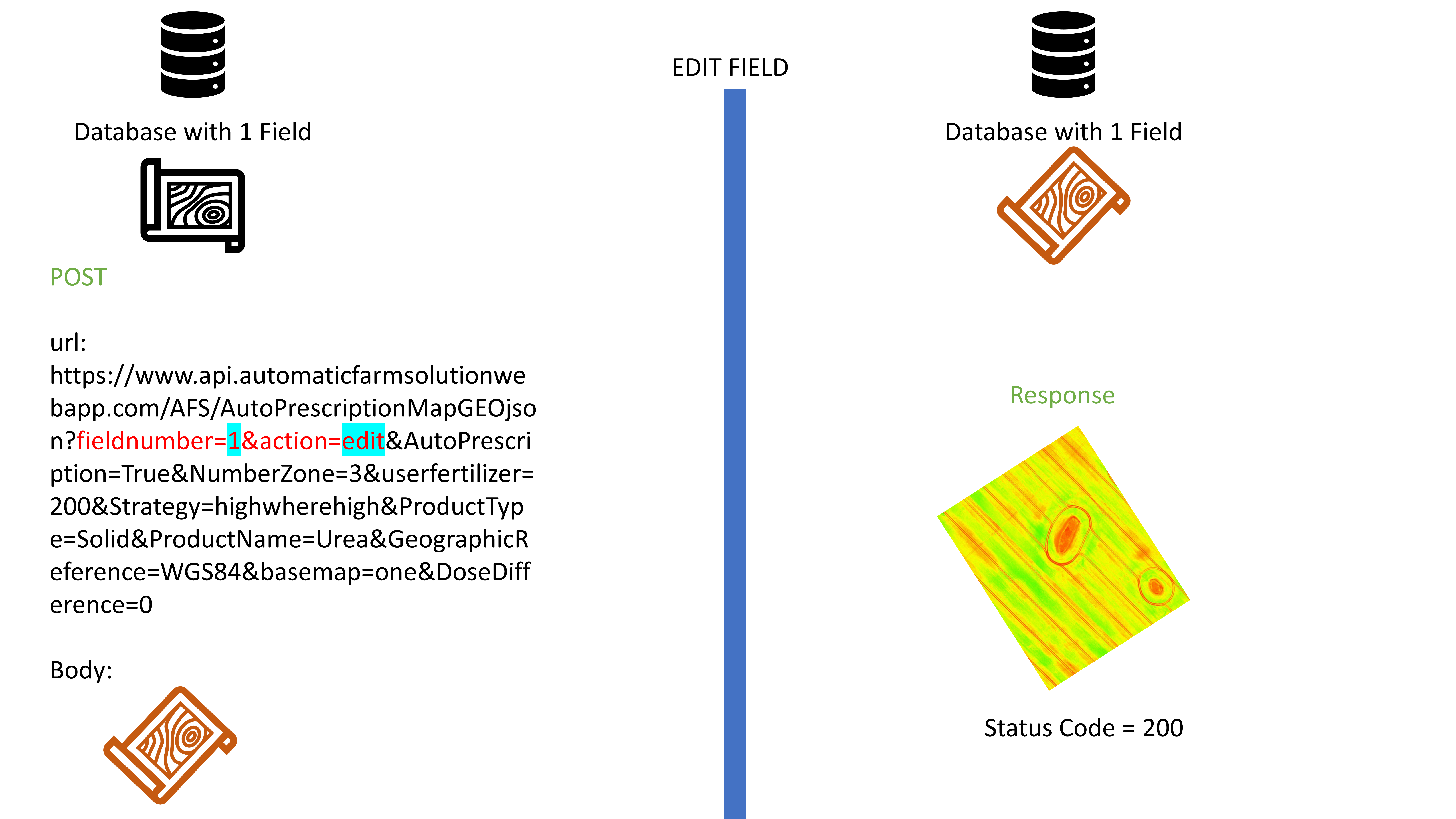
- edit, which mean that the geojson loaded as body section of the request is a new version of the previous saved geojson.
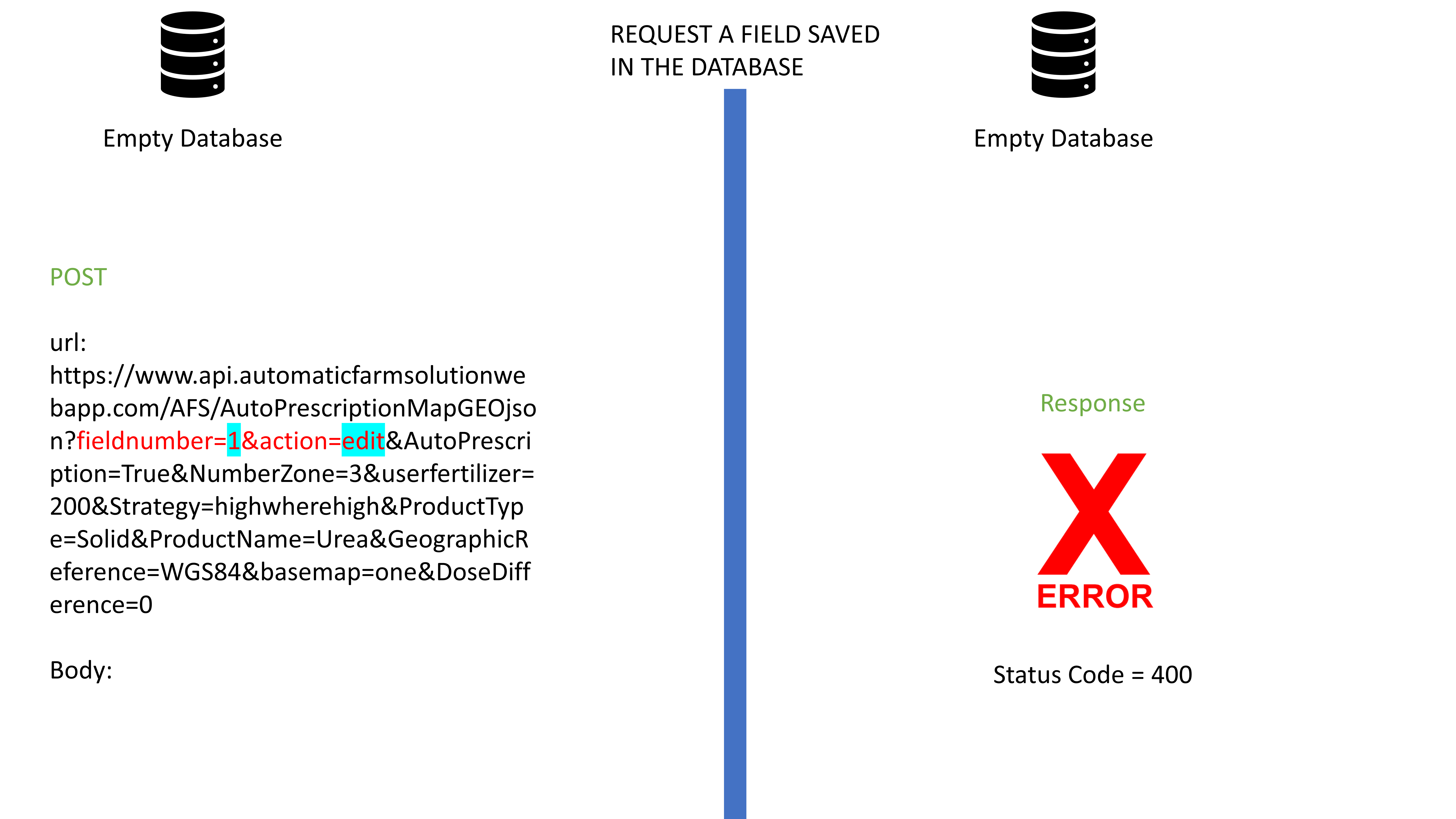
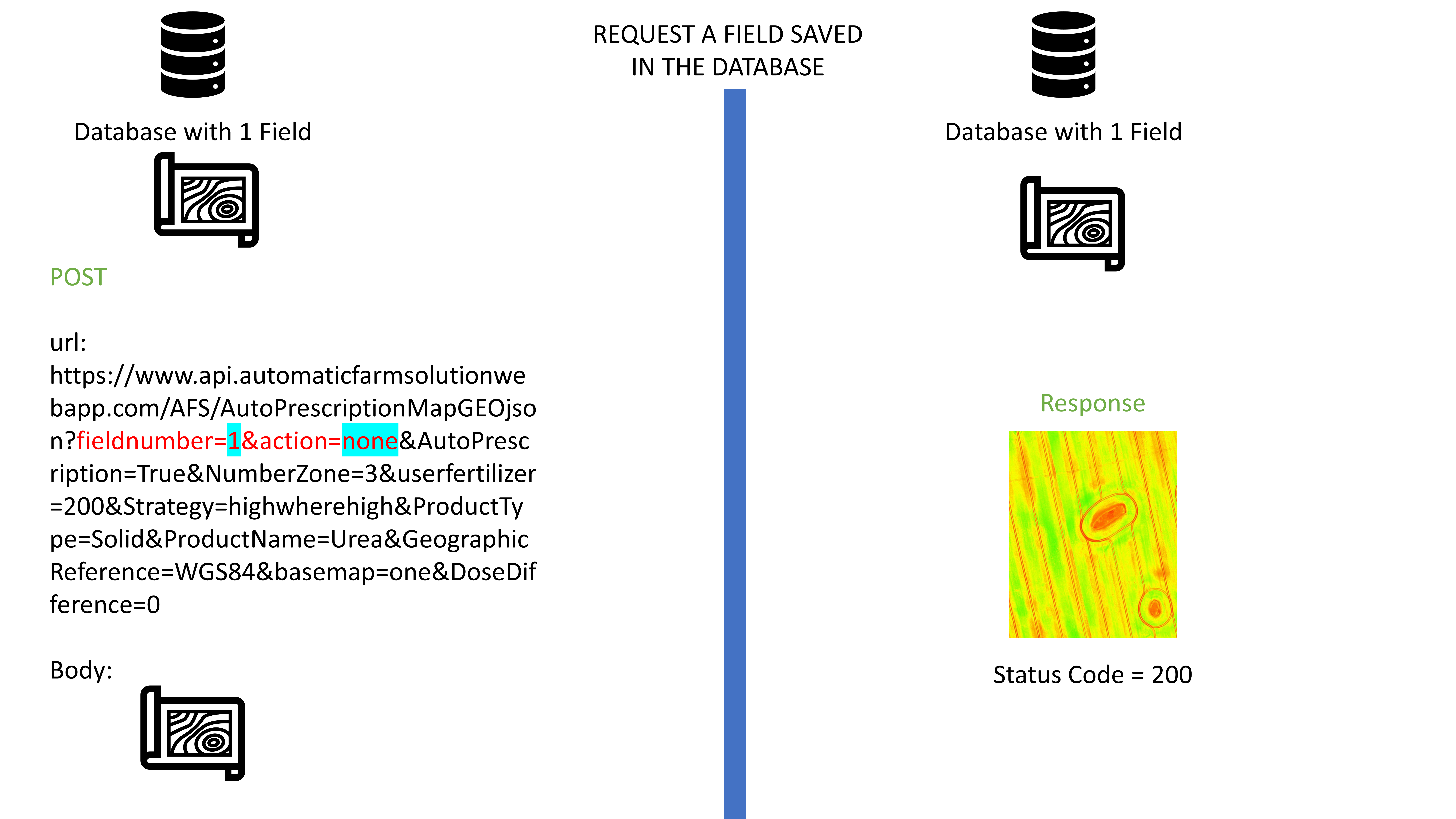
- none, which mean that the geojson loaded as body section is the same as the one in the database.
Whereas for field numbering, incremental numbering must be considered. To call a defined field you must set the fieldnumber API parameter.
Below we will show you several example and how the API will interact with you
Add new field
Request a saved field
Edit a saved field
Add a N. field
Error